Briones Regional Park is the committed hike in Lamorinda. The Lafayette Reservoir is a paved loop you walk in trainers. The Lafayette-Moraga Trail is a flat path you ride a bike on. Briones is dirt, hills, and views — 6,255 acres of open ridge between Lafayette, Orinda, and Martinez, with a trail network serious enough that you bring real water and pay attention to the weather.
It is also, for many Lamorinda regulars, the recovery park — the place you go on a Sunday morning when you want hills, quiet, and a bench at the top to sit on without saying anything. (See The Sunday Hike: Where Lamorinda Goes to Recover From Itself for the field report on that.)
The Bear Creek Staging Area
The Bear Creek Road Staging Area is the local trailhead — the one Lamorinda residents actually use. From downtown Lafayette or Orinda, it’s a 10-to-15-minute drive up Bear Creek Road past the reservoir spillway. There’s a kiosk, a paved lot, restrooms, and a single map board with the trail network. Briones has five major staging areas around its perimeter; Bear Creek is the one on the Lamorinda side.
Hours and fees
- Parking lot: 8 AM to sunset, daily.
- Parking: $5 per vehicle when the kiosk is attended (typically weekends and busy weekdays).
- Cash only. This is the part nobody tells you. There is no card reader. Bring a five.
- Buses: $25 per vehicle.
- Dogs: on-leash on staging areas and developed trails; off-leash permitted in the open backcountry under voice control, on a leash no longer than 6 feet through any cattle area.
The Three Hikes Most People Actually Do
Briones has dozens of trail miles. Most regulars rotate through three loops.
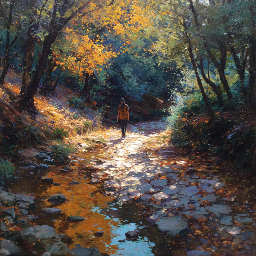
Old Briones Road to the high bench — 2 miles round-trip, ~500 feet of climb. From the Bear Creek lot, head up the Old Briones Road Trail. The first mile is the work — a steady fire-road climb through oak and bay laurel that opens onto grassland near the top. There’s a bench at the saddle with a view east to Mt. Diablo. Most casual hikers turn around here. This is the coffee-and-think hike.
The Mott Peak loop — roughly 4.5 miles, ~1,000 feet of climb. Old Briones Road up to the Mott Peak Trail, summit Mott Peak (1,424 feet), drop down the Black Oak Trail, and return via the Homestead Valley Trail. This is the trail-runner classic — the Strava regulars do it in 47 to 55 minutes; walkers take about two hours. Spring (February–April) has the best wildflowers and emerald hills; by June the ridge is summer gold.
The Briones Crest / Briones Peak loop — roughly 6.5 miles, ~1,400 feet of climb. The bigger outing. Old Briones Road up to the Briones Crest Trail, follow the ridge to Briones Peak (1,483 feet, the highest point in the park), and loop back via the Spengler or Toyon Canyon trails. Three-plus hours for most hikers. Views from the crest run from Mt. Diablo east to Mt. Tamalpais north to the Carquinez Strait and back to the Berkeley Hills. This is the serious-Sunday hike.
For an alternative entry point, the Alhambra Creek Staging Area off Reliez Valley Road in Martinez is fee-free and is the trailhead for the Alhambra Creek and Spengler trails on the park’s north side. (Different drive, less convenient from downtown Lamorinda.)
What You Need to Bring
Briones is not the reservoir. It rewards a little preparation.
- Water. Real water. There are no fountains on the trail. A liter for the short loops, two for Mott or Briones Peak.
- Sun layer. The ridges are exposed — no tree cover above the first half-mile. Hat, sunscreen, sunglasses. Long sleeves in summer are not crazy.
- Real shoes. Trail runners or light hikers. The fire roads are loose gravel in spots and the singletrack sections in oak woodland can be rooty.
- Tick check, March through June. Briones runs cattle in the open grassland. Stay on trail, do a check at the car.
- Cash for parking. See above. The kiosk is cash only.
Cows, Coyotes, and Trail Etiquette
Briones runs an active cattle grazing program across most of its open ridge. Encounters are part of the experience.
- Cattle on the trail: Give them a wide berth, especially if calves are present. Walk around slowly; don’t startle them. Dogs on leash through any active grazing area.
- Gates: Leave them as you found them. Most cattle gates are spring-loaded.
- Mountain bikes: Allowed on specific fire roads only — Old Briones Road and the Briones Crest are open; the singletrack connectors generally are not. Yield to hikers and horses.
- Horses: Briones is a working equestrian park. Hikers and bikes yield. If you meet a horse on a narrow trail, step to the downhill side and speak normally so the horse can hear and place you.
(For the broader unwritten rules of Lamorinda trail use, see Trail Etiquette.)
When to Go
- Spring (February–April): Peak season. Emerald-green hills, wildflowers (poppy, lupine, owl’s clover, mule’s ears), waterfalls in the small canyon creeks after rain. Weekday mornings are exquisite. Weekend afternoons fill up.
- Summer (June–September): Hills are summer gold. Mornings are clear and cool; afternoons are hot and exposed. Be off the ridge by 10:30 AM on hot days. Bear Creek staging fills by 9 AM on warm Saturdays.
- Fall (October–November): Golden grasses, low slanting light, the year’s clearest air for long views. Underrated. Often the best photography window.
- Winter (December–January): Muddy. Some fire roads become near-impassable after big rains. Check trail conditions on the EBRPD site before committing.
Seasonal Note — Late June into July 2026
The hills are firmly summer-gold and the season is in its hottest, driest stretch. Through July and August, the play is early or evening: be at the Bear Creek lot by 8:00 AM for a Mott Peak loop in cool air, or arrive after 6:30 PM for a short Old Briones bench climb in the long-light golden hour. Sunset is at the year’s apex right now — 8:37 PM on June 28 and June 29, ticking back one minute each evening starting June 30 — so the late-evening short loop has its longest runway of the year through about July 10.
Fourth-of-July weekend, July 3–5, 2026. Bear Creek staging traffic is light on the Fourth itself — most Lamorinda regulars are at the Moraga Commons fireworks on Saturday July 4, on the Lafayette Reservoir loop, or barbecuing — which makes Briones one of the quietest Lamorinda outdoor options on the holiday weekend itself. Friday July 3 and Sunday July 5 mornings draw a slightly heavier-than-normal crowd, but it’s nothing like the post-graduation Sundays earlier in June. If you want a long, quiet ridge walk on Independence Day weekend, Mott Peak before 9 AM on Saturday July 4 is a small Lamorinda secret. Pack an extra liter of water — the ridges are exposed, the air is dry, and the lot has no fountain.
Fire weather and red-flag awareness. July through October is the season when East Bay Regional Park District can issue fire restrictions or, in extreme red-flag conditions, full park closures on short notice. Smoking is prohibited park-wide year-round; open flame and ground fires are not permitted at Bear Creek staging (no picnic grills, no camp stoves). Check the EBRPD park status page the morning of any July–October hike, especially after multiple consecutive 95°F+ days or when an offshore wind is forecast. If the staging area gate is closed when you arrive, it is closed for a reason — do not park on the shoulder of Bear Creek Road and walk in.
Tick season is over. The peak tick window in Briones (March through early June) has closed for the year; the open grassland is now dry and the cattle have shifted with the forage. Standard trail hygiene still applies, but the daily tick-check vigilance can ease until the green-up after the first fall rains.
Cattle movement, late June. The grazing herd has shifted off the upper Briones Crest and onto the cooler north-facing slopes. The Mott Peak loop is mostly cow-free in late June and July; expect more cattle encounters on the Spengler and Toyon Canyon trails on the way back down. Same etiquette as always: wide berth, dogs on leash, gates as you found them.
Getting There
From downtown Lafayette: 12 minutes by car. Take Pleasant Hill Road north, left on Bear Creek Road, follow it past the reservoir spillway to the Bear Creek Staging Area on the right.
From downtown Orinda: 15 minutes via Camino Pablo north to San Pablo Dam Road to Bear Creek Road, then continue east to the staging area.
From the Caldecott Tunnel: 20 minutes. Highway 24 east, exit at Camino Pablo (Orinda), then San Pablo Dam Road to Bear Creek Road.
From Moraga: 20 minutes via Moraga Way / Camino Pablo / San Pablo Dam Road to Bear Creek Road.
The staging area is roughly five miles up Bear Creek Road from the San Pablo Dam Road intersection — past the EBMUD watershed entrance, past the reservoir spillway, on the right.
Explore More in Lamorinda
- Lafayette Reservoir — The paved 2.7-mile loop, the everyday option
- Lafayette-Moraga Trail — 7.6 miles of paved rail-trail
- All Things to Do — Full Lamorinda parks and outdoor guide
- Lafayette Guide — The town this trailhead sits next to